By Mary Anna Mancuso, RepublicEn.org
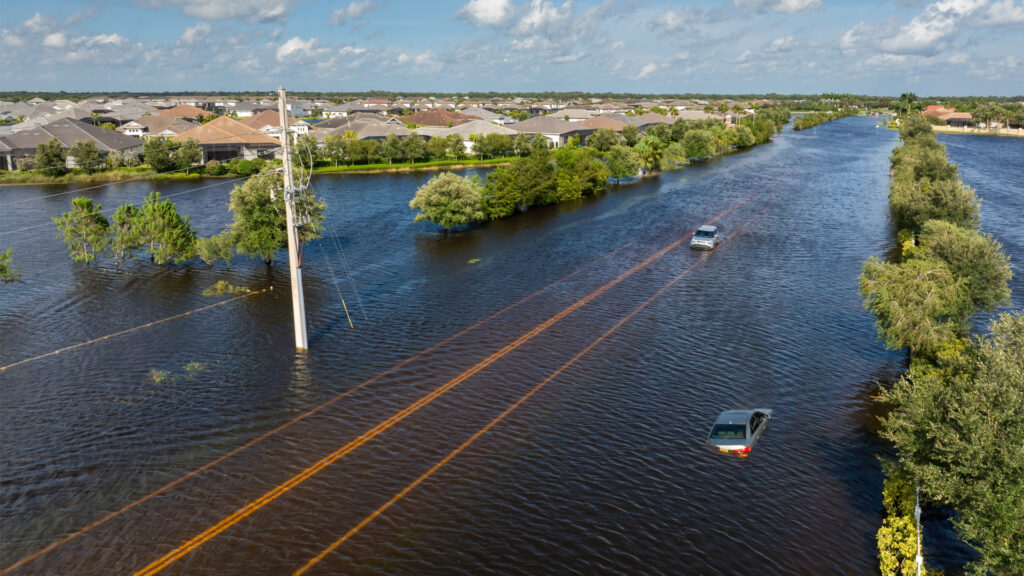
Tropical Storm Debby might not have packed the wallop of a major hurricane, but she left behind unprecedented damage in her wake. As a Category 1 hurricane, Debby wouldn’t typically be seen as a catastrophic threat. Yet, some areas saw historic flooding.
Sarasota and Bradenton saw as much as 18 inches of rain, the fourth most in the state behind Ruskin (21.7 inches), Palm Harbor (20.34 inches), and Parrish (18.86 inches). At the Sarasota Bradenton International Airport, a National Weather Service monitor recorded 11 inches of rainfall, the highest one-day total since recording began in 1911.

When Debby made landfall, she brought the usual suspects: heavy rain, gusty winds and a storm surge. Debby’s deluge on Florida’s Gulf Coast broke records, turning streets (and golf courses) into rivers and flooding homes. The flooding caused by Debby serves as a stark reminder that the rules of the game are changing — and climate change is the new referee.
For decades, Category 1 hurricanes and tropical storms were generally considered manageable by comparison with Category 4 or 5 hurricane. They’d knock down some trees, cause power outages and make a mess of your backyard, but they weren’t expected to flood entire communities.
However, as the planet warms, the atmosphere holds more moisture — about 7% more for every 1°C of warming. The physics are straightforward: Warmer air holds more water vapor, and when that moisture is released during a storm, it can result in devastating floods. Which means storms like Debby are now capable of unleashing torrential downpours that would have been unthinkable in the past.
This trend isn’t just a fluke. Scientists have been sounding the alarm for years, warning that climate change would lead to more intense rainfall and increased flooding, even from storms that aren’t classified as major hurricanes.
As the cleanup continues and the reality of Tropical Storm Debby’s aftermath sets in, one thing is clear: The old assumptions about storm intensity and damage potential no longer hold water. The storms are evolving faster than our preparedness measures, leaving communities such as Sarasota and Tampa Bay vulnerable to devastating impacts from what were once considered “manageable” storms.

Tropical Storm Debby’s impact is a sobering example of how climate change is reshaping our understanding of storm severity. The old metrics — wind speed, storm surge and pressure — are no longer sufficient to predict the true danger a storm poses. We now have to account for the increased potential for extreme rainfall and flooding, even from storms that don’t make the headlines for their winds alone.
As we move forward, in addition to pricing carbon, the most efficient and effective means of reducing carbon pollution, the challenge will be to adapt our infrastructure and disaster response plans to this new normal. Coastal cities, in particular, will need to invest in better flood defenses and drainage systems to cope with the heightened risk. And perhaps most importantly, we need to take meaningful action to mitigate climate change, so that future storms don’t continue to outpace our ability to protect our communities.
Tropical Storm Debby might not have been the most powerful storm on record, but the flooding she caused is a powerful reminder that the climate is changing — and with it, so must we.
Mary Anna Mancuso is a political strategist and a spokesperson for RepublicEn.org, a growing group of conservatives who care about climate change.
If you are interested in submitting an opinion piece to The Invading Sea, email Editor Nathan Crabbe at ncrabbe@fau.edu. Sign up for The Invading Sea newsletter by visiting here.


Debby and the storm that hit Connecticut show us that we need to elevate buildings and harden roads.